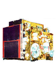
IRS-1A (Indian Remote Sensing Satellite-1A) was India’s first operational remote-sensing satellite, marking a major milestone in the country’s space program. It was designed to provide high-resolution imagery for applications in agriculture, forestry, soil mapping, water resources, and disaster management.
Launch Date: 17 March 1988
Launch Vehicle: Vostok Rocket (Soviet Union)
Launch Site: Baikonur Cosmodrome, Soviet Union
Orbit: Polar Sun-Synchronous Orbit (904 km altitude)
Inclination: 99.2°
Revisit Time: 22 days
Mission Life: 8 years (designed for 3 years)
Outcome: Highly successful
Payload: Two optical imaging cameras
LISS-I (Linear Imaging Self-Scanning Sensor-I)
Resolution: 72.5 m
Swathe Width: 140 km
LISS-II (Linear Imaging Self-Scanning Sensor-II)
Twin sensors (LISS-IIA & LISS-IIB)
Resolution: 36.25 m
Swathe Width: 74 km each (combined 148 km)
Coverage: Captured high-quality multispectral images of India in four spectral bands
IRS-1A was a landmark mission in India’s space history, demonstrating ISRO’s growing capabilities in satellite design and Earth observation. It laid the foundation for India’s self-reliant remote sensing program, benefiting multiple sectors and making India a global leader in satellite-based Earth observation.