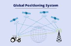
Sanjay, India’s first indigenous vehicle navigation system, was launched in New Delhi. This GPS-based navigation system was developed at the I.B. Saxena Design Lab, making it a pioneering step in real-time vehicle tracking and navigation.
- GPS-Based Navigation:
Used a Global Positioning System (GPS) receiver for real-time location tracking.
Mapped Delhi’s road network, enabling turn-by-turn guidance.
- Voice-Assisted Navigation:
Provided vocal directions to users while driving.
Helped drivers navigate without needing to look at a screen.
- Vehicle Tracking Capability:
Allowed remote tracking of vehicles from a separate location.
Useful for fleet management, security, and emergency response.
- Satellite Connectivity:
Utilized 24 satellites for accurate positioning and navigation.
Ensured reliable tracking and route guidance across New Delhi.
One of India’s first GPS-based vehicle tracking solutions.
Revolutionized urban navigation before smartphones and Google Maps.
Paved the way for modern GPS systems in public transport, logistics, and personal vehicles.
Inspired the development of Indian navigation services, including ISRO’s NavIC satellite system.
Though Sanjay was ahead of its time, modern navigation apps have since evolved, but this innovation laid the foundation for GPS adoption in Indian transportation and security.