The IRS-P4 (Oceansat-1) was India’s first dedicated satellite for oceanographic studies, launched as part of the Indian Remote Sensing (IRS) program. It played a crucial role in monitoring ocean conditions, including sea surface temperatures, phytoplankton, and ocean winds, aiding applications in fisheries, climate research, and coastal studies.
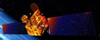
Satellite Name: IRS-P4 (Oceansat-1)
Launch Date: 26 May 1999
Launch Vehicle: PSLV-C2 (Polar Satellite Launch Vehicle)
Launch Site: Satish Dhawan Space Centre (SHAR), Sriharikota, Andhra Pradesh
Orbit: Sun-Synchronous Polar Orbit (SSO) at 720 km altitude
Orbital Period: 99.31 minutes
Mission Duration: Ended on 8 August 2010 (Operational for over 11 years)
Mass: 1,050 kg
Dimensions: 2.8 m x 1.98 m x 2.57 m (9 ft 2 in × 6 ft 6 in × 8 ft 5 in)
Power Supply: Solar panels with NiCd batteries
- Ocean Colour Monitor (OCM):
Purpose: Monitored ocean color, detecting chlorophyll concentration, phytoplankton blooms, and suspended sediments.
Coverage: Scanned a 1,420 km-wide swath with 360-meter resolution.
Fisheries management (identifying potential fishing zones)
Studying ocean productivity and water pollution
Monitoring harmful algal blooms (red tide)
- Multi-frequency Scanning Microwave Radiometer (MSMR):
Purpose: Measured sea surface temperature, ocean winds, and humidity.
Weather prediction and climate studies
Cyclone forecasting
Tracking ocean currents and El Niño effects
Pioneered ocean observation for India, enhancing meteorological and fisheries applications.
Supported cyclone prediction and climate research, improving weather models.
Aided in global ocean studies, collaborating with international agencies like NASA and NOAA.
Provided crucial data for fisheries, helping fishermen locate fish-rich areas more accurately.
After over 11 years in orbit, IRS-P4/Oceansat-1 completed its mission on 8 August 2010.
It was succeeded by Oceansat-2 (launched in 2009) and Oceansat-3 (launched in 2022).